Download presentation
Presentation is loading. Please wait.

1
Geography Unit 1

2
Location Relative Location - The position of one place in relation to another Absolute Location - the exact spot on the earth’s surface where a place is found Latitude - measures north and south Longitude - measures east and west

3
Relative Location of GA
Mason-Dixon Line - boundary between Pennsylvania and Maryland this line became the dividing line between slave and free states Deep South - the heart of the old confederacy: rural and dependent on agriculture (cotton) Deep South includes: SC, GA, FL, AL, MISS, LA, (NC, AK)
 Deep South includes: SC, GA, FL, AL, MISS, LA, (NC, AK)")
4
Using Latitude and Longitude
Equator - dividing point between north and south hemispheres (0o latitude) Prime Meridian - dividing point between east and west hemispheres (0o longitude) International Date Line
 Prime Meridian - dividing point between east and west hemispheres (0o longitude) International Date Line.")
5
Georgia’s Location Northern and Western Hemispheres United States
Southeastern Region of the United States Bordered by 5 states: Florida, Alabama, Tennessee, North Carolina, South Carolina

6
Geographic Regions of Georgia
-- Appalachian Plateau -- Ridge and Valley -- Blue Ridge Region -- Piedmont Plateau -- Coastal Plain Region

7
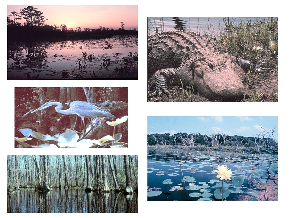
Coastal Plain Region Largest region, three-fifths of state
In prehistoric times, this area was completely covered by ocean Freshwater wetlands - Okefenokee Swamp Grows pine along the coast and further inland is famous for peanuts, peaches, and pecans

8
Coastal Plains

9
Georgia’s Coast Georgia’s coast is in the eastern Coastal Plains region The coast consists of swamps, rivers, salt marshes, estuaries, and islands Estuary - the area around the river’s mouth where fresh and salt water mix Barrier Islands - a chain of islands that form a wall blocking waves and wind from directly hitting the mainland

10
Golden Isles

11
The Golden Isles Georgia’s coast is called the Golden Isles for several reasons: Early explorers expected to find gold here, but did not. Wealthy people settled along the Georgia coast and built huge mansions there in the late 1800’s. When the sun shines on the sand and ocean, it looks golden

14
Piedmont Region Consists of rolling hills with many valleys
Red clay and granite base. Georgia is the largest source of granite in the U.S Most heavily populated region of GA (Atlanta in this region) Rivers in this region are fast moving with rapids and water falls Farms growing cotton, soybeans, wheat, chicken, cows are in this region
 Rivers in this region are fast moving with rapids and water falls. Farms growing cotton, soybeans, wheat, chicken, cows are in this region.")
15
Piedmont Chattahoochee River

16
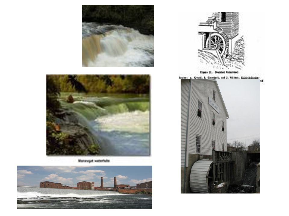
Fall Line Fall Line - boundary between the Coastal Plain and Piedmont regions Fall Line marks the prehistoric ocean shoreline Rivers pick up speed as they “fall” through this region and waterfalls are formed Settlements and industry developed along the Fall Line because swift rivers and waterfalls offered a source of power

18
Blue Ridge Region Located in the Northeastern corner of Georgia
Brasstown Bald - highest point in Georgia is in this region Appalachian Trail begins here and ends in Maine Largest amounts of rainfall in the state are in this region Apples are the main crop Chattahoochee and Savannah Rivers start here

19
Blue Ridge Region Tallulah Gorge Amicalola Falls Brasstown Bald

20
Ridge and Valley Region
Long parallel ridges overlooking wide fertile valleys Sandstone ridges are forest covered and the valleys are used for farming and pasture Region is known for the carpet industry

21
Ridge and Valley

22
Appalachian Plateau Georgia’s smallest region located in the northwestern corner of the state A plateau is flat or sloping elevated land with surrounding valleys Lookout Mountain , Sand Mountain and Cloudland Canyon are here. Georgia’s only source of coal is in this region.

23
Appalachian Plateau

24
Terms to Know Estuary – mouth of a river where fresh & salt water mix
Salt Marsh – saltwater wetland that supports a unique ecosystem important to the fishing industry Okefenokee Swamp – largest freshwater swamp in the U.S. It is 700 square miles and is located in the southeastern Coastal Plain region

25
Continental Shelf Flat underwater ledge from the ocean’s shore to a deep drop off 70 or 80 miles off the Georgia coast.

26
Label these rivers on your map
Chattahoochee Savannah Ogeechee Oconee Altamaha Ocmulgee Flint

27
Georgia’s Climate Climate is weather condition over 25-30 years’ time.
Latitude affects climate because latitude is determined by the distance from the Equator. Georgia’s hot summers and mild winters affected Georgia’s development as an agricultural region. Today many industries are drawn to Georgia for the mild climate.

28
Transportation Georgia’s 3 transportation systems connect Georgia to the rest of the nation and the world. The interstate highway system connects Georgia to other states. Hartsfield-Jackson International airport is one of the busiest in the nation. Georgia’s deep water ports of Savannah and Brunswick are important to international trade.

29
Economic Development The transportation industry supports Georgia’s economy through trade, attracting industry, tourism, and providing jobs.

Similar presentations


>")


